|
Enter an address into the Zoom to Address window to zoom the map to a general area around that address.
For best results enter a complete street address  including
street number, street name, street type, City/Town, State and Zipcode. The Zoom to address tool may also work for incomplete or generalized address
information such as street intersections and place names.
After the address has been entered into the window, click the including
street number, street name, street type, City/Town, State and Zipcode. The Zoom to address tool may also work for incomplete or generalized address
information such as street intersections and place names.
After the address has been entered into the window, click the  button to zoom
the map to that address. A graphic marker button to zoom
the map to that address. A graphic marker should appear on the map indicating the approximate location of the address. should appear on the map indicating the approximate location of the address.
You may use the map tools (outlined below) at any time, to refine the map display by zooming the map in or out or pannning the map to your well location.
|
 indicates that the tool is active. Only one tool can be active at a time.
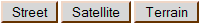 You may change the base map at any time by selecting another option. Street Map and Satellite images provided by Google are
available for all zoom levels. The Google Terrain Map does not support all zoom levels and can not be viewed at the map's maximum resolution. If you are using the Google Terrain map and wish to zoom the map in to the maximum resolution you will need to choose another base map option.
You may change the base map at any time by selecting another option. Street Map and Satellite images provided by Google are
available for all zoom levels. The Google Terrain Map does not support all zoom levels and can not be viewed at the map's maximum resolution. If you are using the Google Terrain map and wish to zoom the map in to the maximum resolution you will need to choose another base map option.