|
|
Enter an address into the Zoom to Address window to zoom the map to a general area around that address. |
|
|
Enter an address into the Zoom to Address window to zoom the map to a general area around that address. |
|
|
The map tools allow you to navigate the map and get coordinate information for a selected location in Massachusetts.
Note: A grey box with a solid black outline surrounding the tool icon |
| Select the Zoom in tool to zoom the map in to a larger scale. You can either click on a single spot on the map to zoom in one zoom level or zoom to a general area by clicking and dragging the cursor to create a selection box around your area of interest. Since the map uses preset zoom levels the resulting extent will be the closest preset zoom level to your chosen area. The Zoom in tool automatically recenters the map display on the selected point or the center of the selection box. | |
| Click the Zoom out tool to zoom the map out. | |
| Select the Pan map tool, then click and drag the map to move around (pan) on the map in any direction. | |
| Click the Zoom to full extent tool to zoom the map out to the maximum extent. This will return the map display to the default extent of the State of Massachusetts. | |
| Select the Get XY tool and then click on the map to display coordinate information for the selected location in a pop up window. | |
| Click the Go to previous extent tool to return the map back to a previously viewed map extent. | |
| Click the Go to next extent tool to zoom the map forward if you had previously used the Go to previous extent tool to zoom back. |
|
|
This map contains three base map options. |
|
|
If you require further assistance using this tool, please email questions to... |
 including
street number, street name, street type, City/Town, State and Zipcode. The Zoom to address tool may also work for incomplete or generalized address
information such as street intersections and place names.
After the address has been entered into the window, click the
including
street number, street name, street type, City/Town, State and Zipcode. The Zoom to address tool may also work for incomplete or generalized address
information such as street intersections and place names.
After the address has been entered into the window, click the  button to zoom
the map to that address. A graphic marker
button to zoom
the map to that address. A graphic marker indicates that the tool is active. Only one tool can be active at a time.
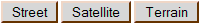 You may change the base map at any time by selecting another option. Street Map and Satellite images provided by Google are
available for all zoom levels. The Google Terrain Map does not support all zoom levels and can not be viewed at the map's maximum resolution. If you are using the Google Terrain map and wish to zoom the map in to the maximum resolution you will need to choose another base map option.
You may change the base map at any time by selecting another option. Street Map and Satellite images provided by Google are
available for all zoom levels. The Google Terrain Map does not support all zoom levels and can not be viewed at the map's maximum resolution. If you are using the Google Terrain map and wish to zoom the map in to the maximum resolution you will need to choose another base map option.